|
Original Construction Year
|
2009
|
|
Most Recent Rebuild Year
|
|
|
Total Cost
|
0.00 |
|
Total Capital Cost
|
$0.00
|
|
Latitude / Longitude Method
|
Unknown
|
|
Latitude
|
40.491944
|
|
Longitude
|
-80.290556
|
|
Elevation
|
1160
|
|
Project
|
McCaslin Road
|
|
Project Type
|
Passive Treatment System
|
|
Project Status
|
|
|
AMD Source
|
Underground
|
|
Stream
|
West Fork of Enlow Run
|
|
Watershed
|
|
|
River Basin
|
Ohio
|
|
Quad
|
Clinton, PA
|
|
City/Township
|
Clinton
/ Findlay Township
|
|
County
|
Allegheny
|
|
State
|
PA
|
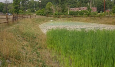
Description: A passive system was installed to treat the acidic, metal-bearing discharge (MP5) from the abandoned Clinton Lake underground coal mine located west of Clinton Road (SR3089) in Findlay Township, Allegheny County. Discharge may also be influenced by surface mining of the crop coal. An Auto-flushing (siphon) limestone VFP was installed to double as limestone stockpile at the township building.